There were 3 CROWS teams out on the Pennine Way today. This was our second attempt - last Wednesday was a total wash out - to squeeze in a work party before the arrival of another storm. This week it was Storm Agnes that was on her way!
Team 1 (Ian S and Rich) dealt with several stone slabs that had become loose; Team 2 (RJ and Kasher) cut back the path on the embankment of Middle Dean Reservoir and Team 3 (Frank H and Ray) worked on several waymarking tasks and stabilised a collapsing section of pathway
Work today was funded by Natural England and Calderdale Council Highways.
The details
Team 1
Rich and Ian had the longest walk - nearly into Bradford!
 |
| The stone slabs had slipped sideways and were very wobbly |
 |
| Stones slabs re-centred and secured |
3 other large slabs were similarly re-aligned.
Team 2
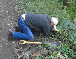
RJ and Kasher dealt with encroaching heather and bracken alongside the reservoir drain.
 |
| RJ somewhere in there! |
 |
| Getting the path away from the edge |
 |
| Finished section |
Finally, they tidied the tread areas of some steps we put in last year.
Keeping an eye on the weather, these two teams managed to finished their tasks before Storm Agnes arrived. Lucky! Lucky!
Team 3
Frank H and Ray started the day near Heptonstall by installing a markerpost near Hollins, off Lee Wood Road (the Heptonstall 'by-pass'). The start was slightly delayed because we turned down the wrong track and then became puzzled when the terrain didn't match the map. Whoops! However, despite the narrow track, Ray neatly turned his car and we found the correct location! Work began:
One markerpost hole being dug to take markers indicating the Calderdale Way Link Path and also two right-of-way footpaths. (All designated as Heptonsatll 054 on Calderdale's definitive 'Leisure and Culture' Map)
Calderdale Way Link Path clear and obvious straight ahead with another footpath (just out of shot) going diagonally up to the left.
Then it was over to Widdop to do some waymarking of the Pennine Way (PW) by Walshaw Dean Lower Resevoir. We had neatly fixed Pennine Way 'acorns' to a drystone wall when a closer read of the jobsheet revealed it was the wrong wall. Whoops again!
Fortunately the problem was swiftly resolved. The PW 'acorn' waymarks look like this:
By early afternoon, we finally got our act together and walked across the reservoir wall to install a marker post at an important junction on this section of the PW.
The rain was coming down steadily at this point (hence the blurry picture) but the markerpost has the PW 'acorn' and also other footpath disks that specifically indicate the PW route. This section of the Pennine Way seems to be exceptionally well waymarked!
We then moved on, getting increasingly wet (thanks Agnes), to rectify a section of path where stone flags and blocks had slipped at the edges of a minor drainage channel. We re-bedded and pinned the offending stonework (no photographs as the camera was too wet!) before retreating to the vehicle. At which point the rain stopped! Hooray!
Time to return to base and realise, despite waterproofs, we were damper than we thought! Join CROWS for a good rinse, we say!


